
Nom
ESGLÉSIA DE SANTA MARIA DE VIU DE LLEVATA
Autor
Període
Siglo XI
Tipus
Monument
Direcció
Carretera de Viu de Llevata a la Pobla de Segur s/n Pont de Suert, el (Alta Ribagorça)
Descripció
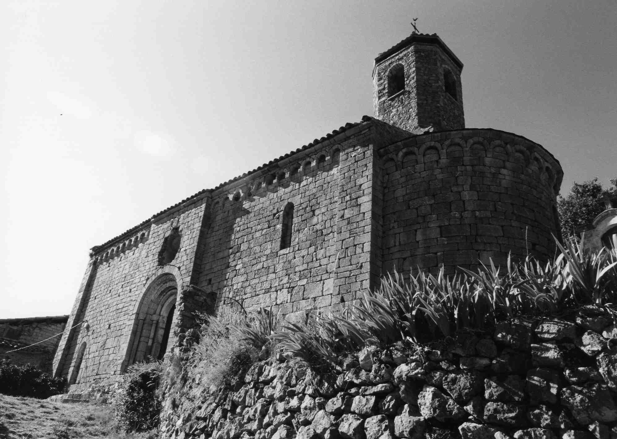
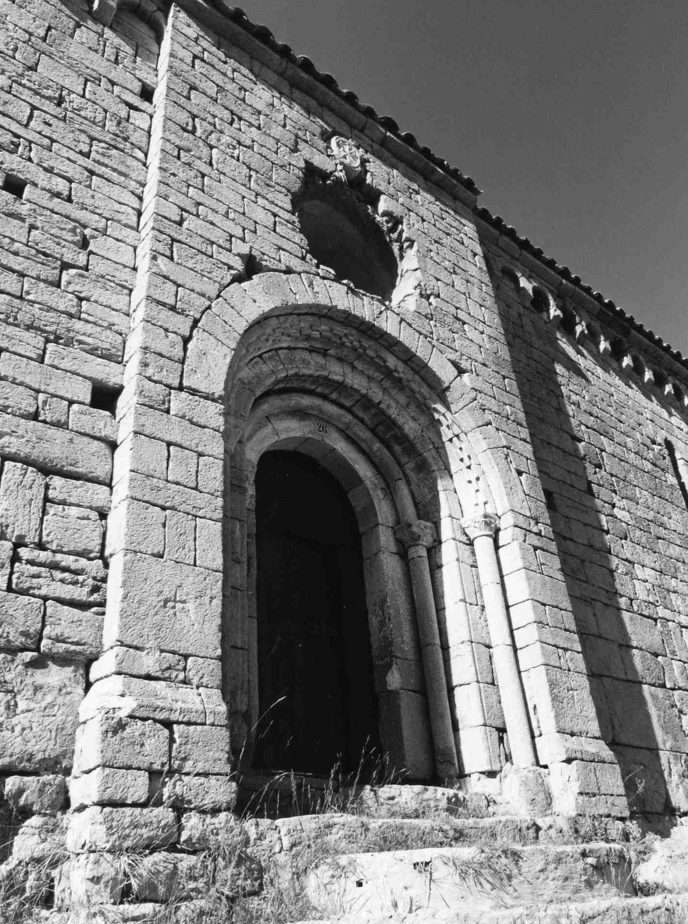
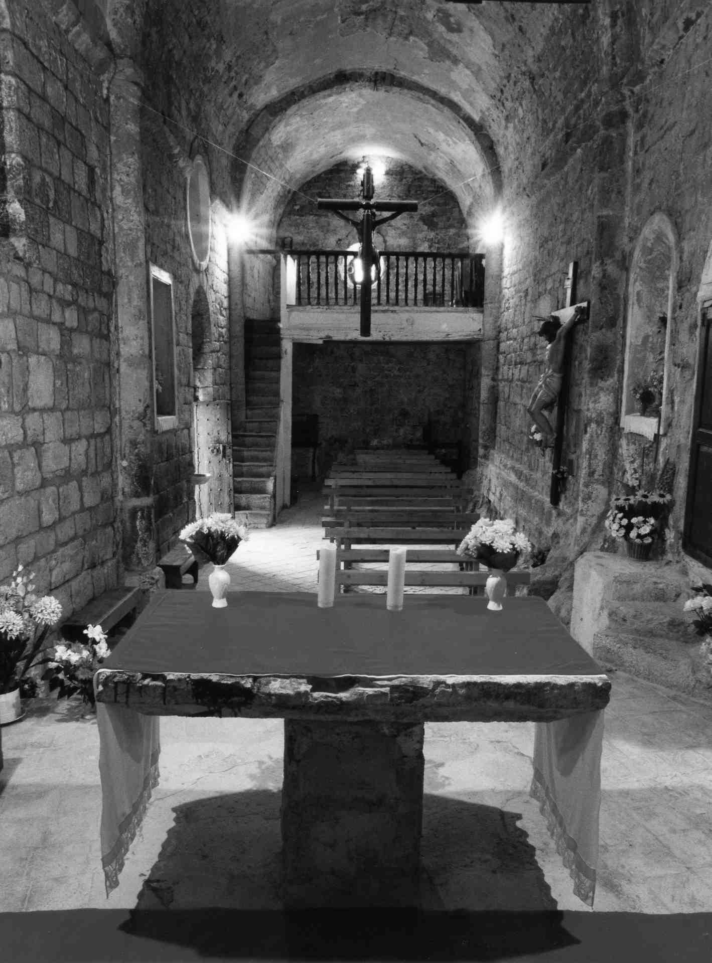
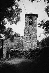
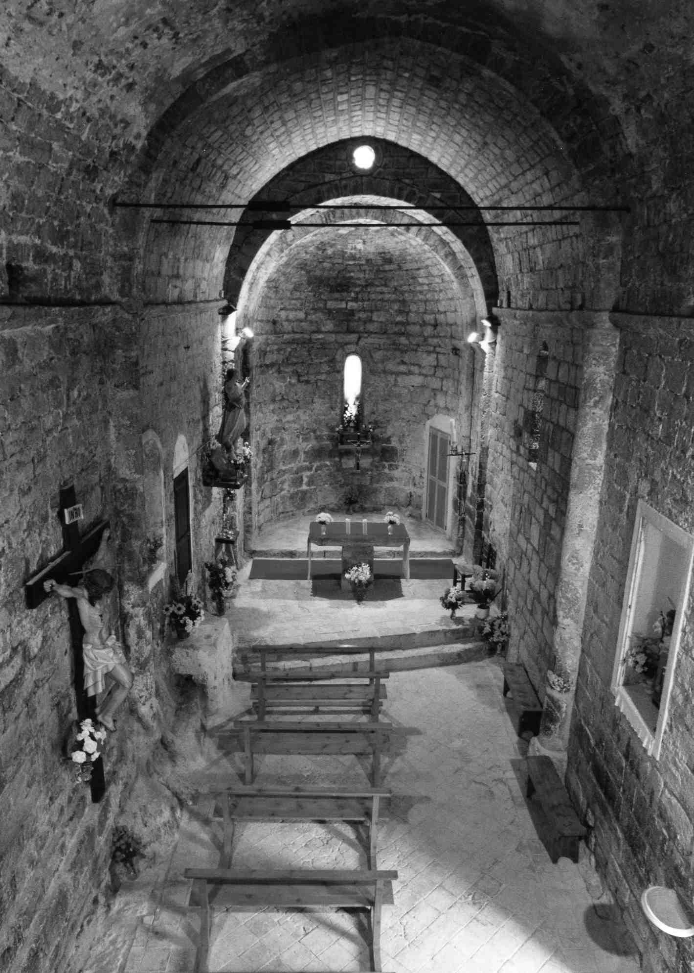
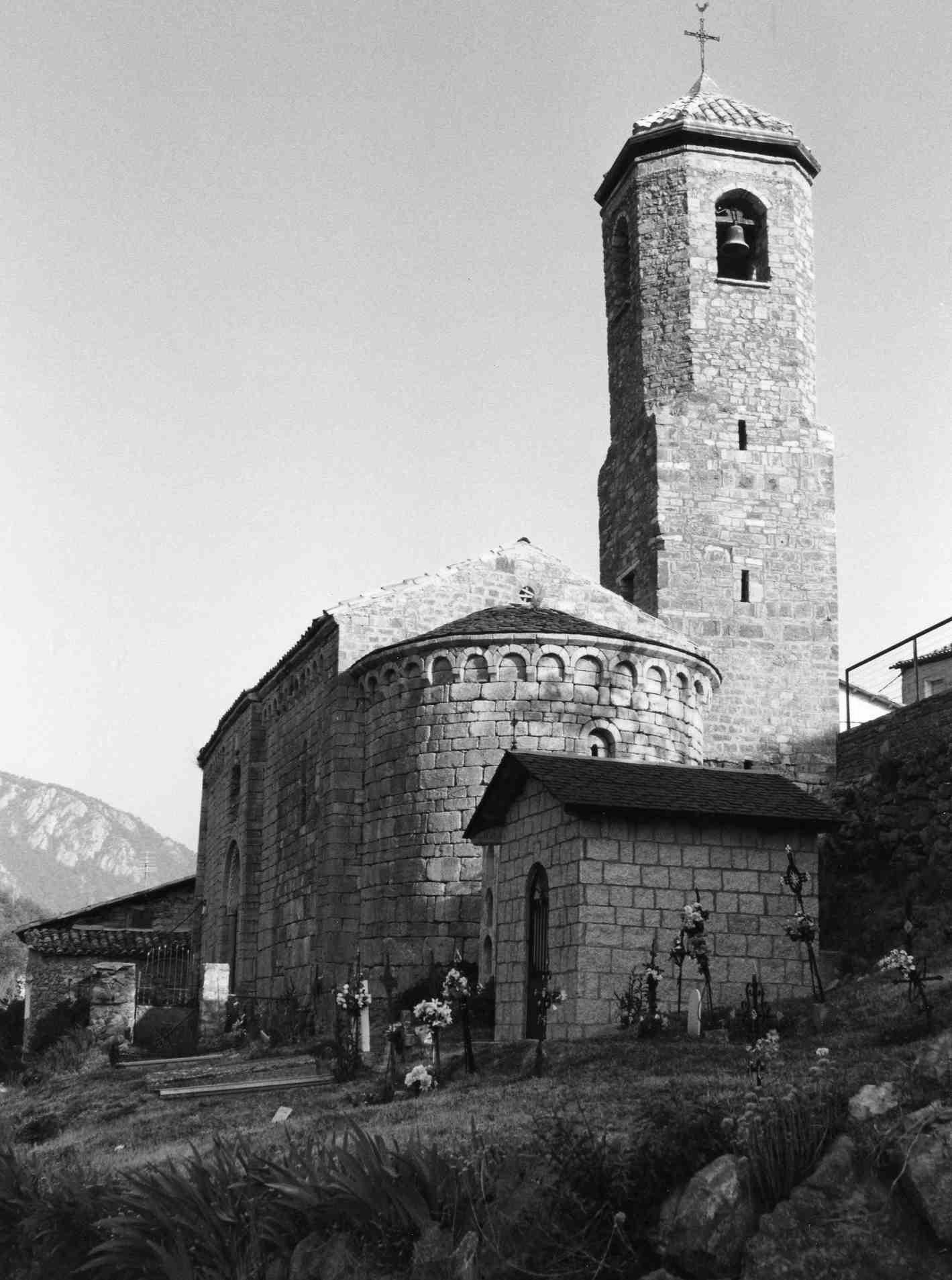
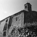
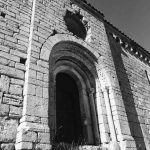
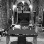
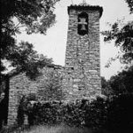
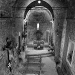
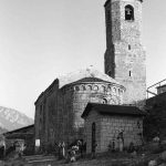
L'església de Santa Maria és disposada en un desnivell del terreny, presidint el nucli de Viu de Llevata. És d'una sola nau tancada a la capçalera per un absis semicircular resseguit per arcuacions llombardes com les que articulen els murs de l'edifici, en especial la façana de migdia. L'absis, amb una doble arcuació, conté una obertura circular a la part més elevada i una finestra romànica en el seu centre. L'edifici és d'una sola nau, amb volta de canó, sostinguda per dos arcs torals que descansen damunt de dues semicolumnes emparades en els murs. En el tram del peu, la volta original es va esfondrar i es reféu amb pedra sense treballar. El capitell d'una de les dues columnes situades a tramuntana presenta una decoració antropomòrfica amb una figura animal, a banda i banda, de factura senzilla que desdiu de la resta de treballs. Encarada devers el pendent, on trobem l'accés que s'articula a partir d'una graonada que condueix al marc d'una porta inscrita en un cos sobresortint, que interromp la sèrie d'arcuacions sota cornisa que recorren el mur. La portada pròpiament dita és formada per tres arcs en degradació que inscriuen dues arquivoltes, llisa la interior i l'altra amb treball d'escacat. Aquesta darrera recolza damunt de columnes amb capitell amb estilitzacions vegetals mentre que la primera ho fa sobre columnes de capitell figurat. L'ordre de façana es completa amb un òcul circular i un crismó. Assolint l'alçada de la cornisa i marcant l'eix centralitzat que articula simètricament tot el pany de paret, si bé cal tenir en compte el volum d'un cos afegit en el marge més proper al presbiteri. En el campanar, adossat a la banda septentrional, és perceptible una intervenció en dues fases. La meitat inferior, de planta quadrada, presenta un parament similar al de la resta de l'església, de carreus disposats en filades, al mateix temps que la meitat superior se'n diferència per tenir angles aixamfranats i una organització de parament força més irregular. S'hi obre la zona que pertoca a les campanes, immediata a la coberta de forma piramidal.